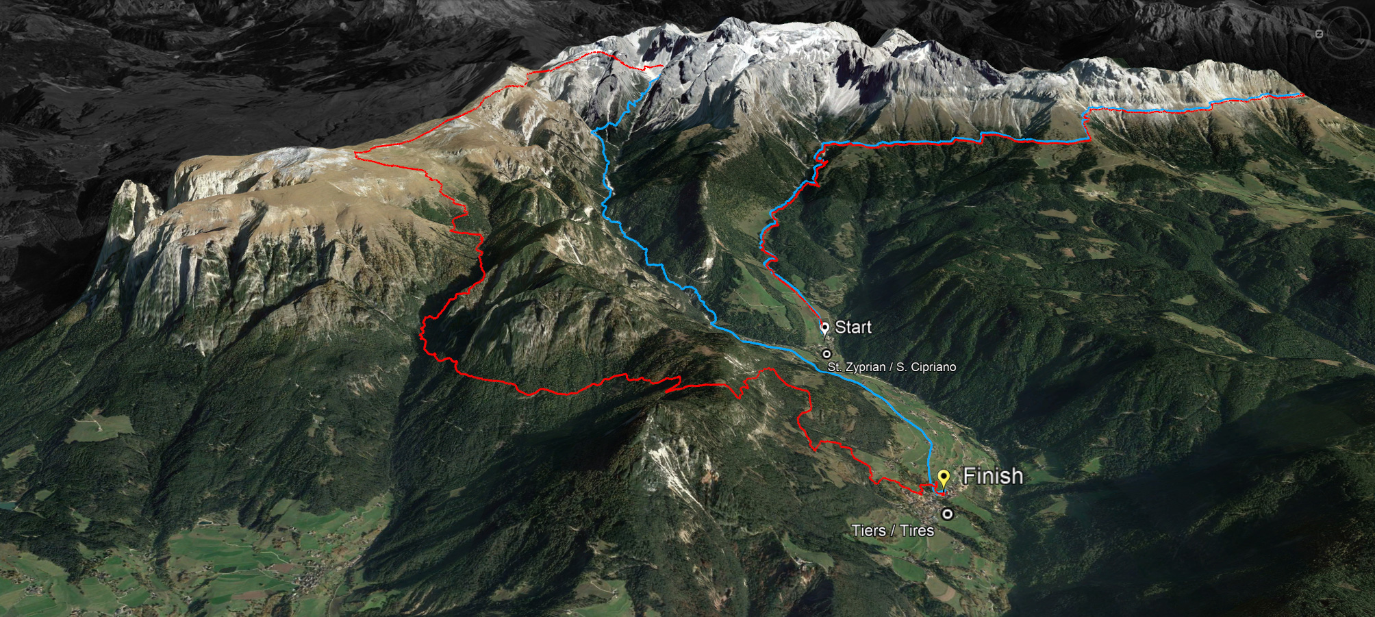
The Skymarathon Rosengarten Schlern is a jewel among mountain runs. On July 8, Tiers will become a mecca for trail runners from Italy and abroad. The four defending champions of the last edition will be at the start: Vice World Champion and three-time Italian champion in trail running Andreas Reiterer, Regina Spiess, Luca Clara and Katharina Esswein.


More than 500 runners from 20 nations have registered. Especially athletes who are competing in the run for the first time arrive earlier to get to know the course. In cooperation with the main sponsor Dynafit and the Mountain Shop Tiers, there is the opportunity to test the new running shoe Ultra 100 at Tires from July 3 to July 7.
Muscles, joints and tendons are put under a lot of strain, especially during trail running. A good shoe is the most important thing for runners. The new Ultra 100 is comfortable, stable, very breathable and suitable for both daily training runs and long distances.
In the photo from left to right:
Klaus Pircher - Mountain Shop Tires, Julia Ausserdorfer, Bernhard Rieder, Renate Bosin – Organizing Committe Skymarathon Rosengarten Schlern, Stefan Rainer – CSO Oberalp Group

Follow us on Facebook
https://www.facebook.com/RosengartenSchlernSkymarathon/

abendrot

45 km

LONG ROUTE
Ascent: ca. 2.980 m
Descent: ca. 3.083 m
Download GPX-Track

The long route of 45 kilometres with a 2,980 metre ascent and a 3,083 metre descent leads over the Cigolade Pass (variant towards Ciamedie and Gardeccia if unviable), the Passo Principe/Grasleitenpass and the Molignon Pass to the Sciliar; after the Devil's Gorge - also known as the Prügelweg – a final ascent leads up to the Tschafon before the finish line in the centre of the village of Tiers.
Due to its length and the difference in altitude it is a mountain marathon. The name "Sky Marathon" describes the length and alpine characteristics of the trail run at over 2,000 metres. 
noasphalt

profil45

36 km

SHORT ROUTE
Ascent: ca. 1.908 m
Descent: ca. 1.935 m
Download GPX-Track

The short route stretches over 36 kilometres with 1,908 metres of ascent and 1,935 metres of descent. It follows the same route as the long track around the Rosengarten massif until the highest peak, Passo Principe/Grasleitenpass. Then it leads down to the Rufugio Bergamo/Grasleitenhütte, through Ciamin Valley/Tschamintal, Lavina Bianca/Weißlahnbad e Oberstraße back to the centre of the village of Tiers.
profil36

karte

karte

karte
© geiger-webdesign.com
We use cookies

We use cookies on our website. Some of them are essential for the operation of the site, while others help us to improve this site and the user experience (tracking cookies). You can decide for yourself whether you want to allow cookies or not. Please note that if you reject them, you may not be able to use all the functionalities of the site.