Registration for the sixth edition of the Rosengarten Schlern Skymarathon on 8 July 2023 is open. The aim of the organizers is not to organize a mass event, but to give a maximum of 500 mountain running enthusiasts an unforgettable nature and sports experience.
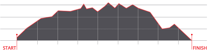
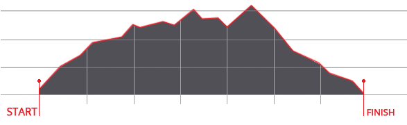
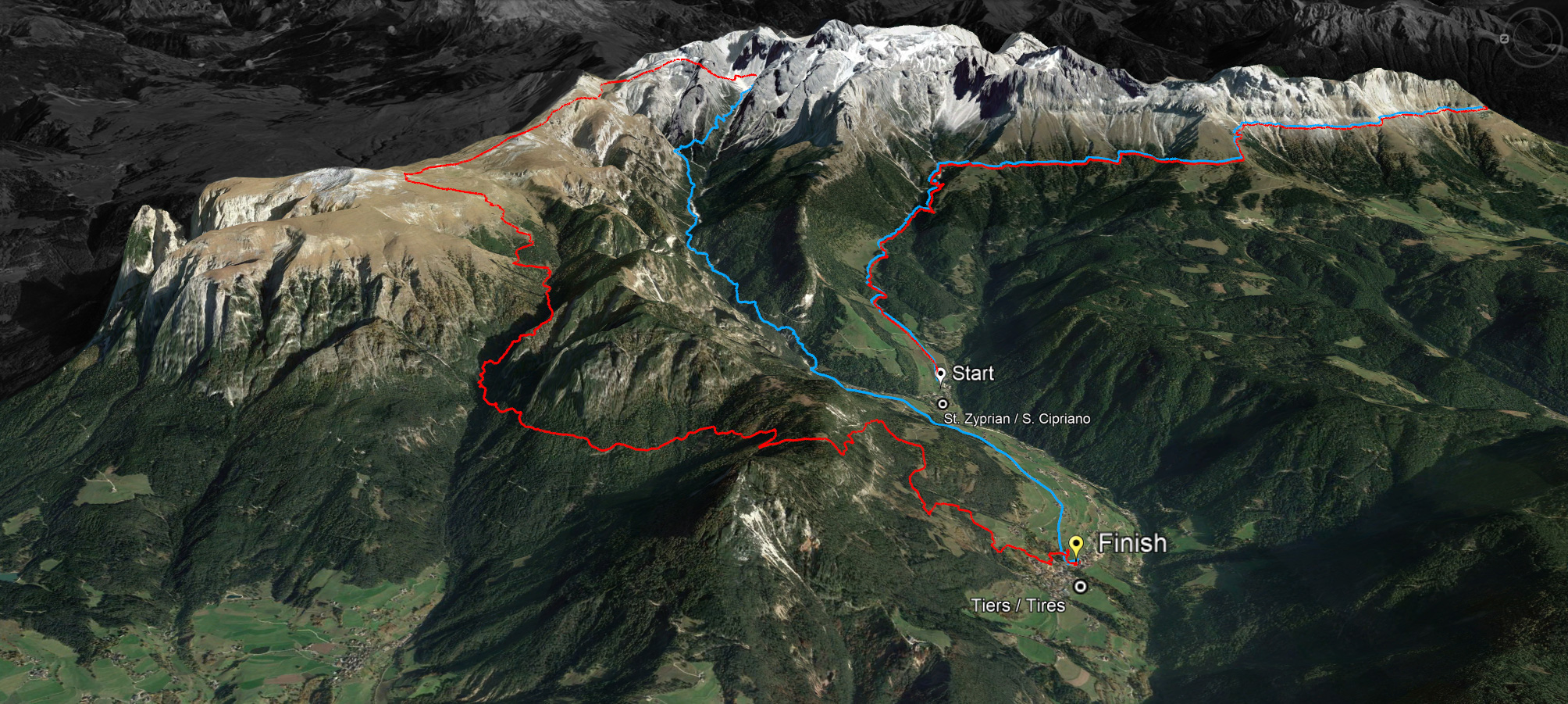
“Small but fine” is the motto of the Rosengarten Schlern Skymarathon, which offers local, national and international trail running lovers a unique running adventure in the UNESCO World Heritage Site. It is not the 45 kilometers and not the 3,000 meters of altitude that make this run so challenging, it is the ground - and trail runners love this technically demanding run, whose long route is 100 percent asphalt-free!
Since 2009, the Catinaccio and the Sciliar as part of the Dolomites are a UNESCO World Heritage Site and the organizers attach great importance to organize an event in harmony with nature. In this, there is total agreement with the main sponsor Dynafit. Dynafit is a brand of the Oberalp Group, which has been committed to sustainability for years.
Women and men who have reached the age of 18 on 8 July 2023 are eligible to participate. There are four men's and three women's categories (M1 18 to 39 years / M2 40 to 49 years / M3 50 to 59 years and M4 over 60 years as well as W1 18 to 39 years / W2 40 to 54 years and W3 over 55 years). Until 31 May 2023 the participation fee costs € 70 for the long distance which is over over 45 kilometers and 3,000 meters of altitude difference and € 65 for the short distance over 36 kilometers and 2,000 meters of altitude. Afterwards the participation fee costs more.


 We use cookies