The Rosengarten Sciliar Skymarathon in the small mountain village of Tiers in South Tyrol is not an ultra run, but it's still something special and with 45 kilometres without asphalt it is a small jewel among trail running events. The fourth edition will take place on 11 July 2020, 500 runners are accepted.
Poisonous climbs, such as those at the Moglignon Pass, will be made up for by the unique panorama in the middle of the World Heritage Rosengarten. "Fantastic and thank you for organizing" was the comment of a Frenchman with goose bumps at the finish. This was his first time in the race and he was absolutely thrilled by the landscape and the familiar atmosphere.
The field of participants is a mixture of athletes and amateur athletes from over 10 nations, which gives the mountain village of Tiers a very special flair on the race weekend. Many runners know each other, and just about everyone raves about the course, which is the same for both distances (36 and 45 km) up to the Grasleiten Pass, the highest point at 2,601 metres above sea level.
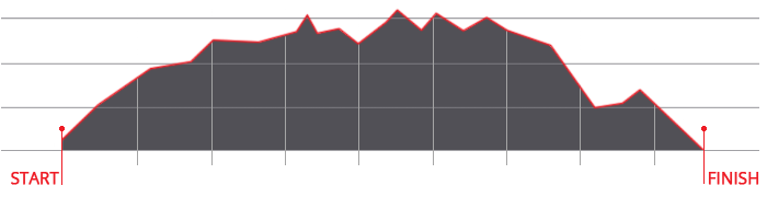
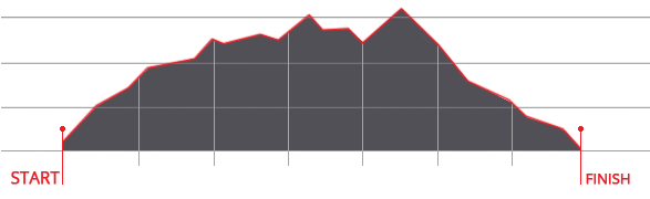
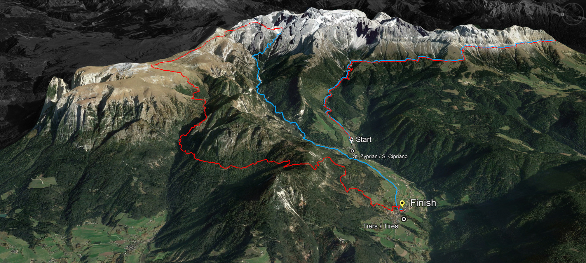
Start is at 7 am in St. Zyprian and those who have not crossed the Grasleitenpass at 12.30 pm have to change to the short course and will not be qualified. The short course covers about 36 kilometres with 2000 metres of altitude difference and leads via the Grasleiten hut and the Tschamin Valley back to the village, while the runners who decide to do the 45 kilometres with 3000 metres of altitude difference still run over the Molignopass towards the Schlern, down the famous Prügelsteig and up the Tiers local mountain Tschafon as a last ascent, before they head towards the finish at the village square, where the runners are warmly welcomed and catered for by the sports club.
Information about the race, regulations and registration at www.skymarathontiers.it


 We use cookies