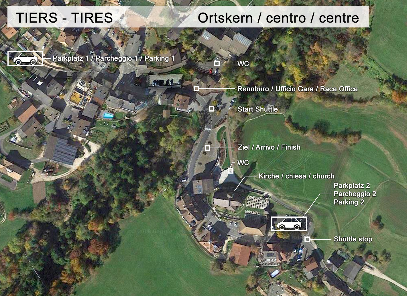
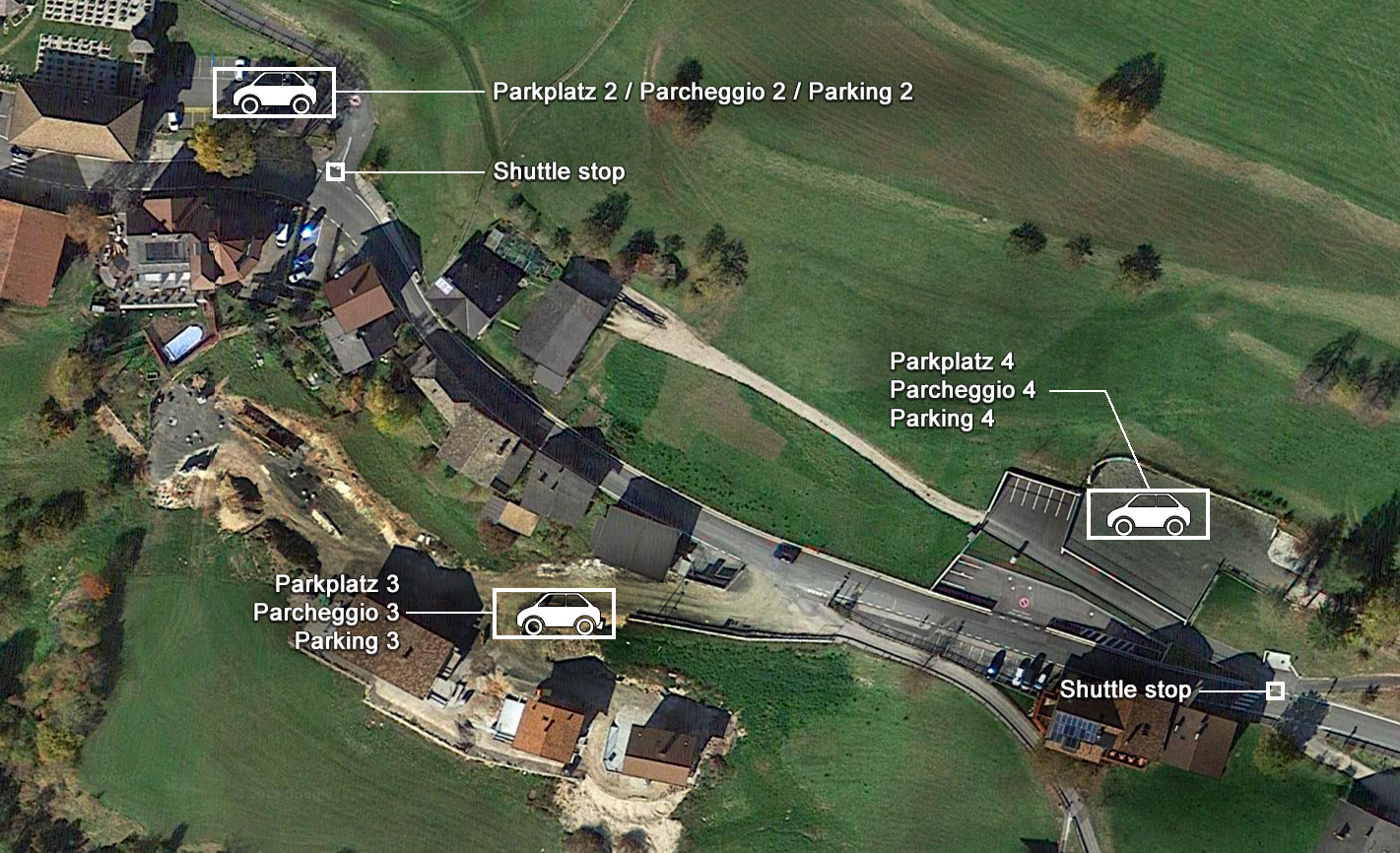
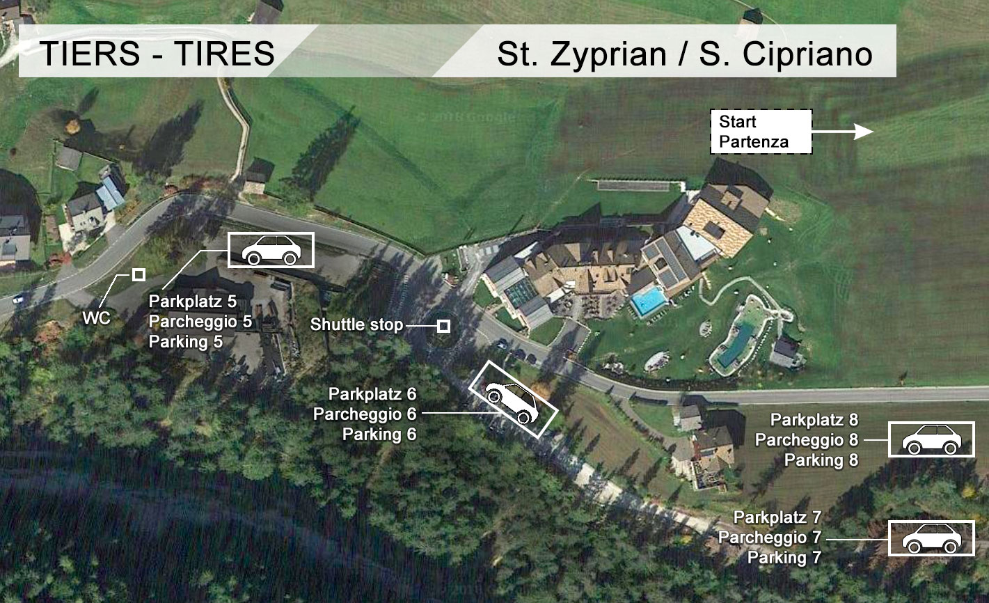
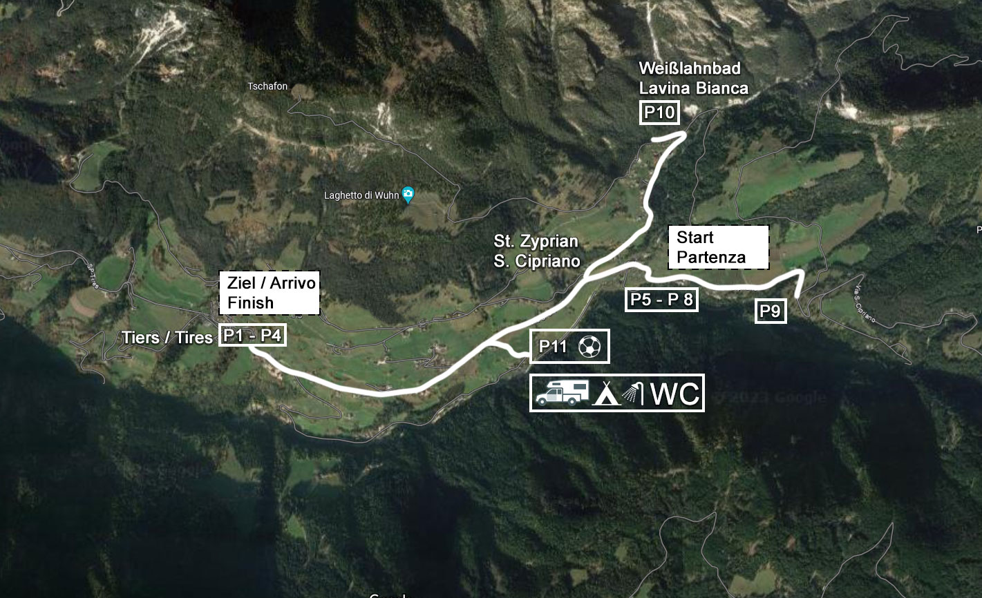
Parking is available both in the village centre and in the starting area.
Parking 9 for camper (Runggun)
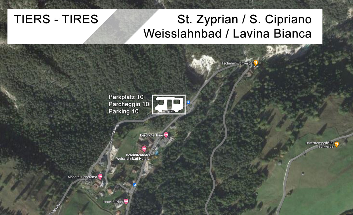
Parking 10 for camper (Lavina Bianca)
Parking 11 for vans & tents (football ground Gemeier)
A free shuttle bus will take all runners from the village centre to the starting area in San Cipriano before and after the race.
(Shuttle: +39 378 0845636).


 We use cookies