Athletes can sign up here:

RACE ENTRY 2026 from January 1st
CLOSING DATE: 12 am the day before the race
LIMITED STARTING PLACES
A maximum of 500 athletes can register for the race.
The organizer reserves the right not to accept additional registrations and to adjust the maximum number of participants. The date of registration applies.
All national and foreign athletes who have reached the age of 18 on the day of the race, took out FISKY assurance and have submitted a medical certificate are eligible to participate.
Participants residing in Italy must submit a sports medical certificate for athletics issued by the sports physician and valid on the day of the race according to Art. 5 -D.M.18.02.1982.
Participants residing abroad must submit a medical certificate valid on the day of the race in accordance with the legal regulations in force in Italy. A copy of the medical certificate can be downloaded HERE.
ENTRY FEE
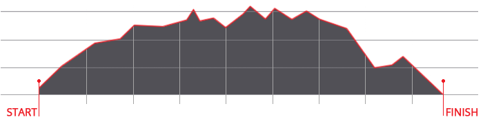
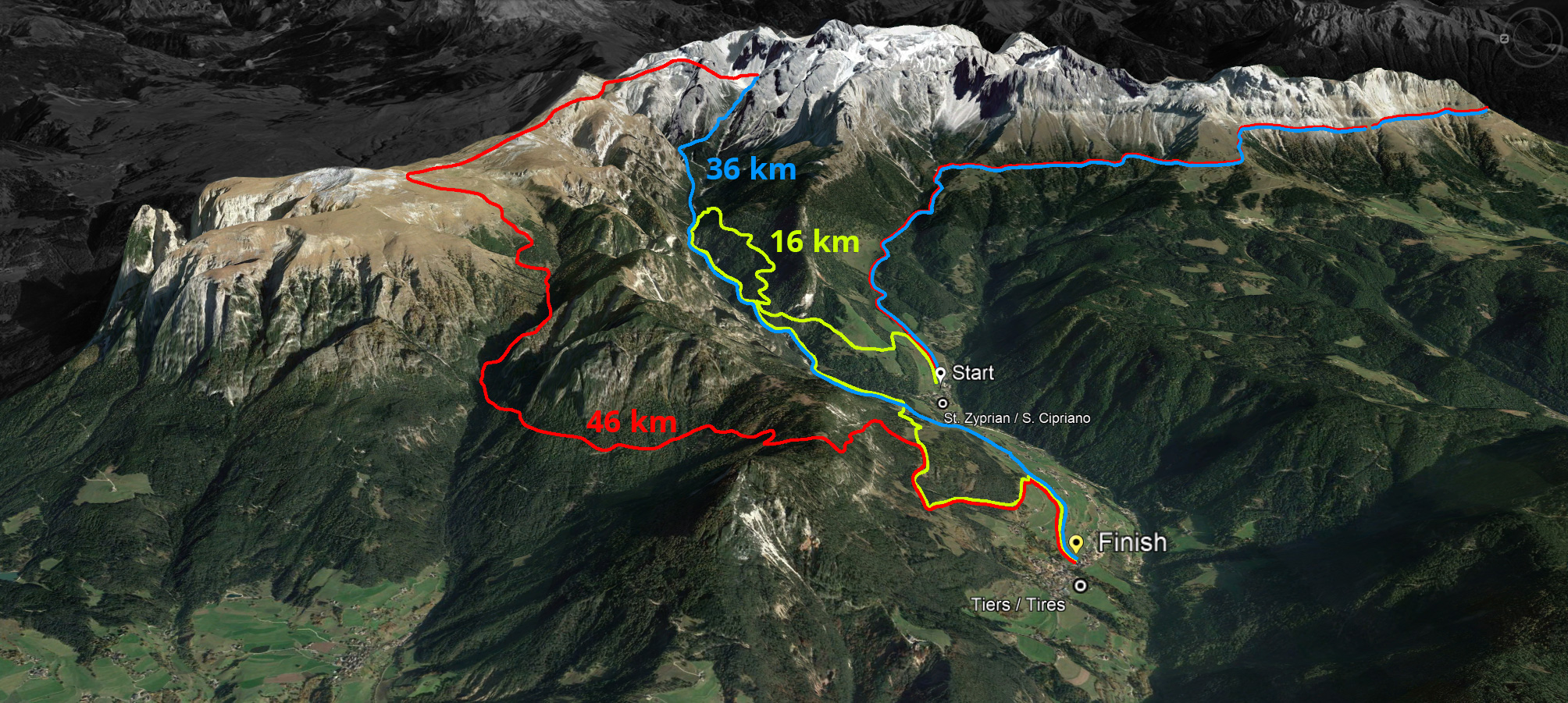
46 km - no asphalt
€ 80,00 by 31 May 2026
€ 95,00 from 1 June 2026
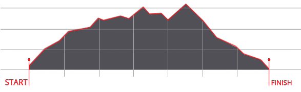
36 km
€ 75,00 by 31 May 2026
€ 90,00 from 1 June 2026
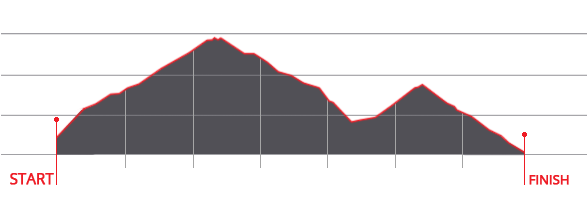
16 km
€ 70,00 by 31 May 2026
€ 85,00 from 1 June 2026


 We use cookies