All important information about the race is summarized in the race rules. The organizer points out to read the regulations carefully and wishes you much success and fun during the race!
The RACE BIB can be collected at the
Race office in the village centre of Tiers (St. Georgstraße 73, 39050 Tiers)
- Day before the race 4:00 - 9:00 pm
- Race Day 5:30 - 6:15 am (8:15 am for the Sky Run 16 km)
SHUTTLE SERVICE
Durin the race day a free shuttle bus takes all runners from the village centre to the starting area and back to the starting area after the race. (Shuttle: +39 378 0845636).
BAGGAGE ROOM at the race office
The sport bags must be marked with the tag on your race bib and will be taken to the race office by the organisers after the start. After the race, the bags must be picked up by showing your race number before 06:30 pm. No valuables or fragile items should be kept in the runners' bags. The organizer accepts no responsibility for any items lost or damaged during the return transportation to the race office.
BRIEFING for the race at 6.45 am in the starting area. Participation is compulsory.
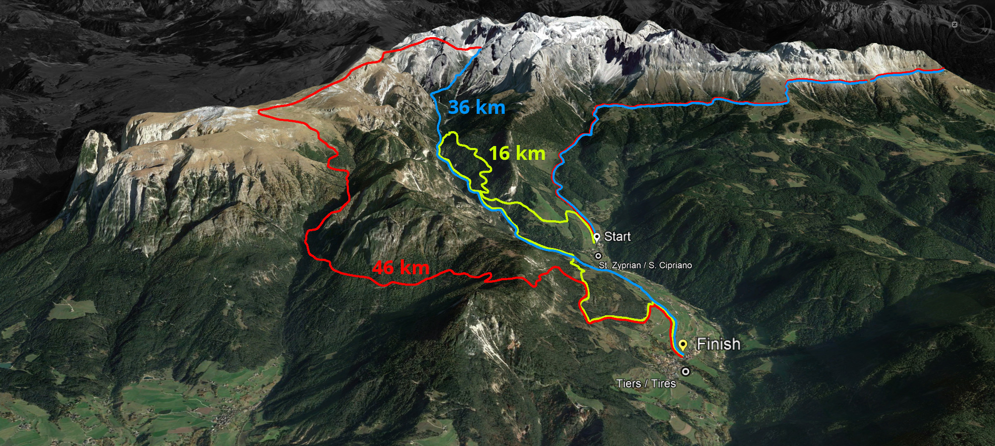
START is at 7.00 am near Hotel Cyprianerhof Dolomit Resort | 9.00 am start Sky Run (16 km)
AWARD CEREMONY will be in the finish area in the centre of the village at around 3 pm
Feast from 10.00 am onwards (voucher included in the race pack)
SHOWERS & WC
Showers at the soccer field
Public toilets at the Culture House, the cemetery and the cable car valley station.
INFO FOR SPECTATORS:
6:00 Uhr Opening Cafe Bakery Tratter
7:00 Uhr Opening cabrio ropeway S. Cipriano/Tires (1.100m a.s.l.) to Rifugio Cornelle (2.337m a.s.l.)
HAPPY HOUR TICKET
All passengers who purchase a ticket at the valley station of the Tierser cable car between 7.00 and 8.00 am on the day of the Skymarathon will receive a special price to experience the race on the Hirzelsteig up close:
Rosengarten Pass € 27,50 instead of € 39
Single trip € 13,00 instead of € 18,50
Round trip on the Cable Car Tires € 18,50 instad of € 26,00
Important telephone numbers:
- 112 for emergencies
- Rescue leader of the race in the BRD Tiers Nr. +39 335 7588299
- Race director Bernhard Rieder: + 39 335 6181972
- Info Point/Race office +39 348 3035481 & +39 349 5056802
- Shuttle Bus +39 378 0845636


 We use cookies