After being cancelled in 2022 due to a tragic accident, the Skymarathon Rosengarten Schlern will return to the racing calendar on 8 July 2023. You can save on registration until 31 May.
The maximum field of 500 runners has almost been reached due to the numerous confirmations from the previous year, which is why the organizers advise not to wait any longer to register.
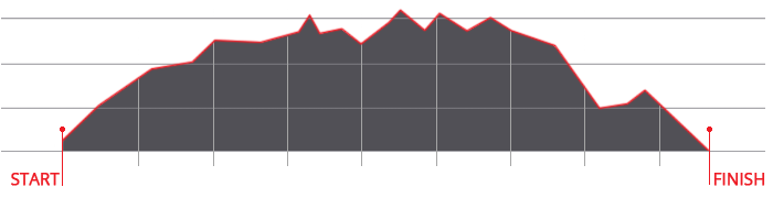
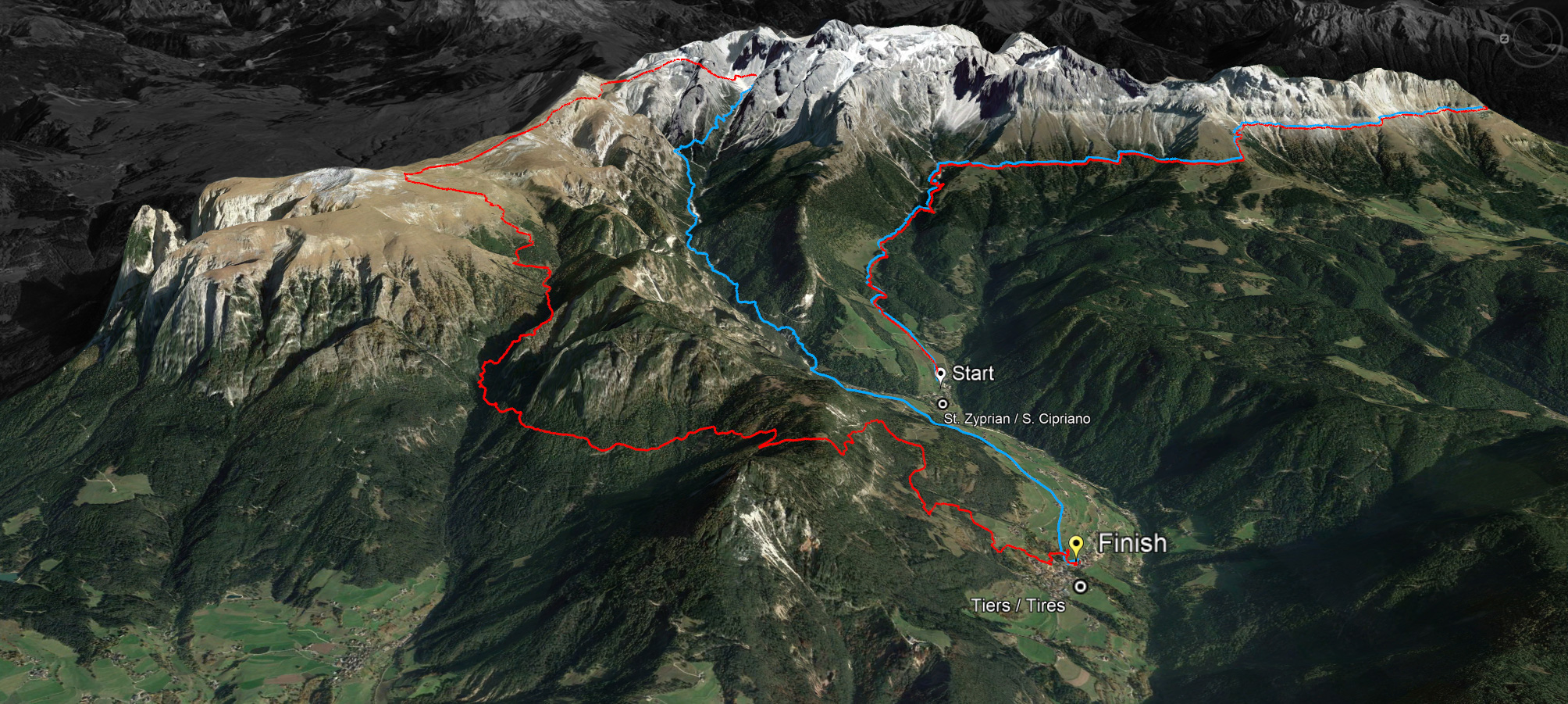
Currently athletes from 15 nations are at the start and the organizers are curious to see how high the proportion of South Tyroleans will be this year, who will face the challenge of the 45 kilometers without asphalt and 3000 meters of altitude difference or 36 kilometers and 2,000 meters of altitude.
The three-time Italian champion in trail running, Andreas Reiterer, was the only one to succeed in this challenge under a time of five hours. In general, the 2021 edition was firmly in the hands of South and North Tyrol: Andreas Reiterer from Avelengo and Regina Spiess from The Sarentino Valley won in the supreme discipline (45km) as well as Luca Clara from Val Gardena and Katharina Esswein from Innsbruck on the short distance (36km).
While the athletes complete the race and five to six hours, the maximum time limit is set at ten hours, for amateur athletes and all those who do not want to keep their eyes on the rather technical ground while running, but also want to enjoy the unique panorama in the middle of the UNESCO World Heritage Dolomites.
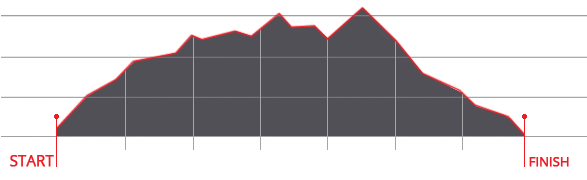
Exactly one week earlier, on July 2, 2023, the Alpe di Siusi Half Marathon will take place, starting at 9:00 a.m. in Compatsch.


 We use cookies