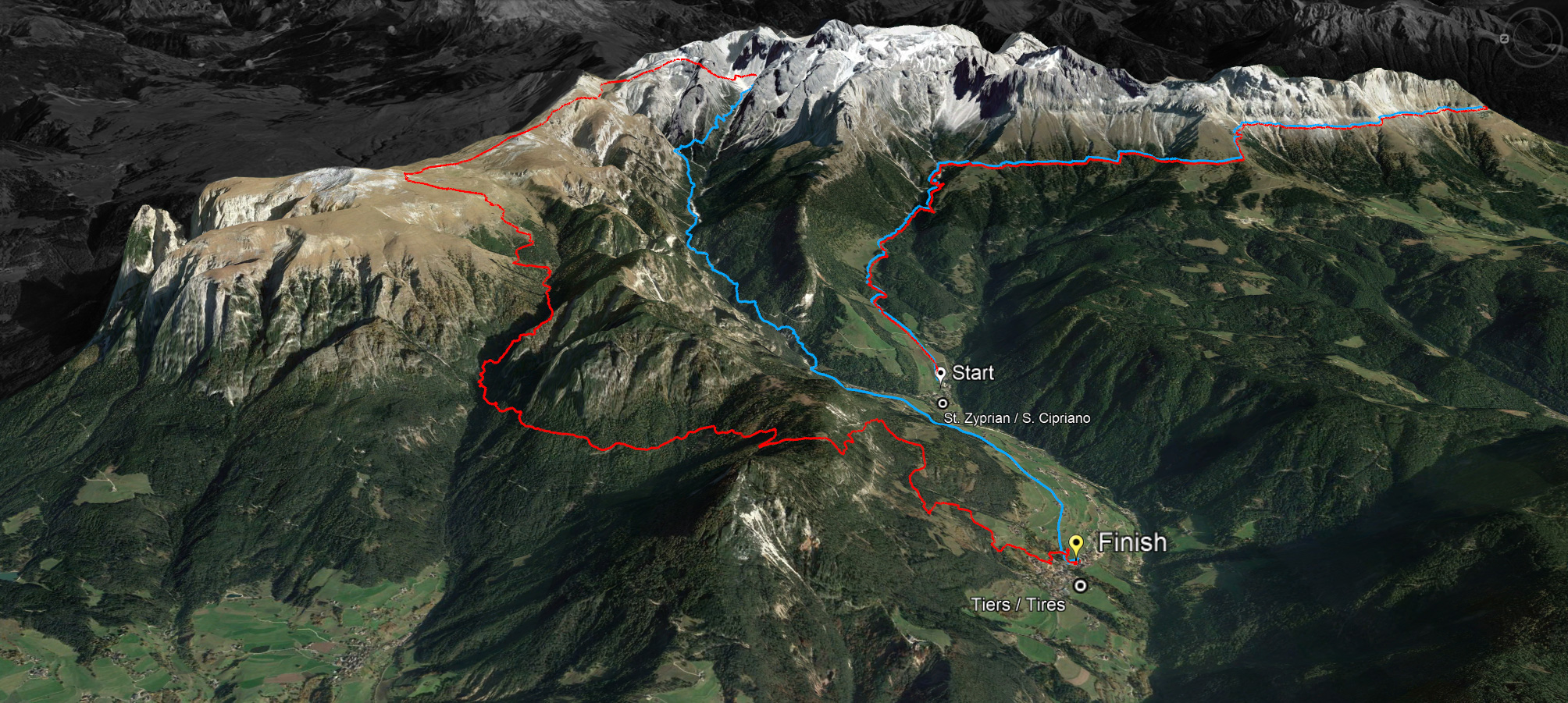
On Saturday 13 July, the seventh edition of the Rosengarten Schlern Skymarathon will take place in Tiers. This run, supported by Dynafit, is not a mass event, but an insider tip for trail runners in the UNESCO World Heritage Site of the Catinaccio/Rosengarten Schlern. The start is at 7 am in St. Zyprian.
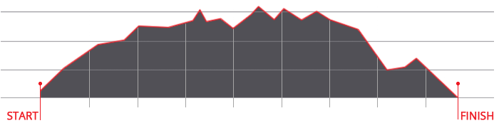
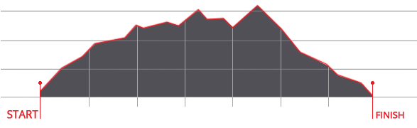
A special feature of this race is that the long route offers 45 kilometres of running pleasure in a unique mountain setting without asphalt; the second route is 36 kilometres long and does not lead over the Molignon Pass towards Schlern, Prügelteig and Tschafon, but via the Tschamin Valley back to the village centre.


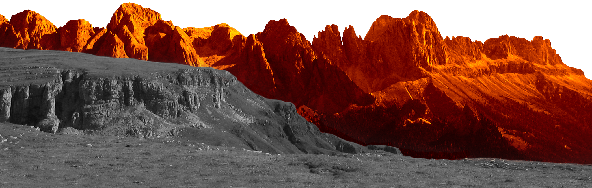
On the second Saturday in July, international running enthusiasts mingle with the South Tyrolean mountain running elite in Tiers. More than 400 athletes from around 25 nations have registered. Local hero Daniel Pattis is one of the favourites this year. The race circles the Catinaccio massif, which is classified as a World Heritage Site, and runs partly through the Sciliar-Catinaccio Nature Park, which was founded 50 years ago.
The limitation to a maximum of 500 entries is primarily for safety reasons, but also out of respect for the environment. Waste avoidance rules apply: for example, it is strictly forbidden to throw rubbish away while running! To avoid plastic cups at the refreshment stations, each runner brings their own drinking vessel. At the end of the field of runners are the so-called broom runners, who have the task of collecting the markers.
The fastest runners complete the long course in five hours, the maximum race time is ten hours. The event is accompanied by a festival organised by the Tiers music band, which provides food and drink as well as musical entertainment with a band and deejay in the evening.

abendrot

Sky Marathon 46 km

Start: 7.00 am
Ascent: ca. 2.980 m
Descent: ca. 3.083 m
Download GPX-Track

The route of 46 kilometres with a 2,980 metre ascent and a 3,083 metre descent leads over the Cigolade Pass (variant towards Ciamedie and Gardeccia if unviable), the Passo Principe/Grasleitenpass and the Molignon Pass to the Sciliar; after the Devil's Gorge - also known as the Prügelweg – a final ascent leads up to the Tschafon before the finish line in the centre of the village of Tiers.
Due to its length and the difference in altitude athletic preparation and a head for heights are prerequisites. The name "Sky Marathon" describes the length and alpine characteristics of the trail run at over 2,000 metres. 
noasphalt

profil45

Sky Trail 36 km

Start: 7.00 am
Ascent: ca. 1.908 m
Descent: ca. 1.935 m
Download GPX-Track

The Sky Trail stretches over 36 kilometres with 1,908 metres of ascent and 1,935 metres of descent. It follows the same route as the Sky Marathon around the Rosengarten massif until the highest peak, Passo Principe/Grasleitenpass. Then it leads down to the Rufugio Bergamo/Grasleitenhütte, through Ciamin Valley/Tschamintal, Lavina Bianca/Weißlahnbad e Oberstraße back to the centre of the village of Tiers.
profil36

Sky Run 16 km

Start: 9.00 am
Ascent: ca. 770 m
Descent: ca. 900 m
Download GPX-Track

The Sky Run (max. 100 bibs) loops through the Ciamin valley to Rechten Leger and then leads back to the village of Tires via Wuhn Leger and St. Sebastian.

profil16

karte

karte

karte
© geiger-webdesign.com
We use cookies

We use cookies on our website. Some of them are essential for the operation of the site, while others help us to improve this site and the user experience (tracking cookies). You can decide for yourself whether you want to allow cookies or not. Please note that if you reject them, you may not be able to use all the functionalities of the site.