Tiers, January 2, 2025 - Registration for one of the most scenic trail runs in South Tyrol has been open since New Year's Day. The 8th edition of the Rosengarten Schlern Skymarathon on Saturday, July 12th will once again attract mountain sports enthusiasts with its two tried and tested routes in the heart of the Dolomites UNESCO World Heritage Site.
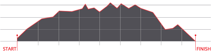
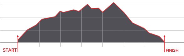
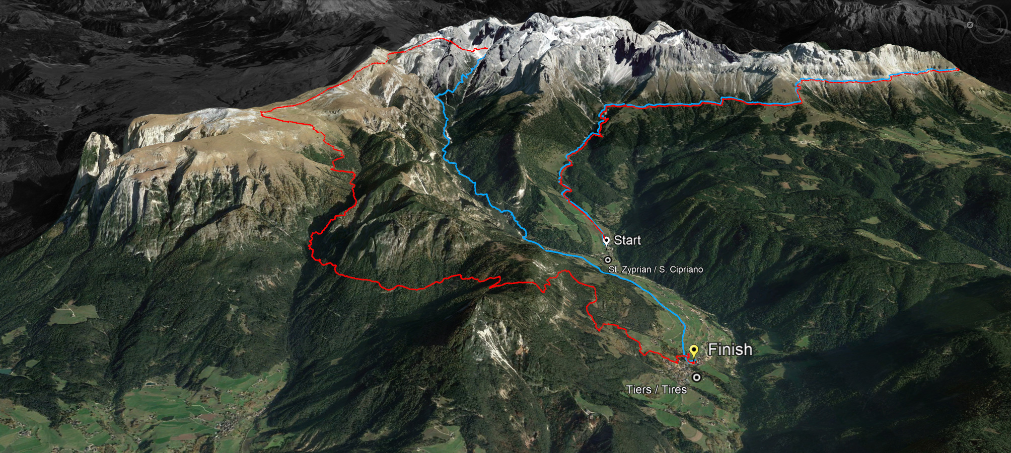
With around 1000 inhabitants, Tiers am Rosengarten is a small, romantic mountain village. But once a year in midsummer, the village becomes a Mecca for the international mountain running scene. Namely when the Rosengarten Schlern Skymarathon is held, which is scheduled to start at 7 a.m. on Saturday, July 12.A maximum of 500 mountain running enthusiasts will then tackle one of the two routes - 45 kilometers with an altitude difference of around 3000 meters or 36 kilometers with an altitude difference of around 2000 meters.
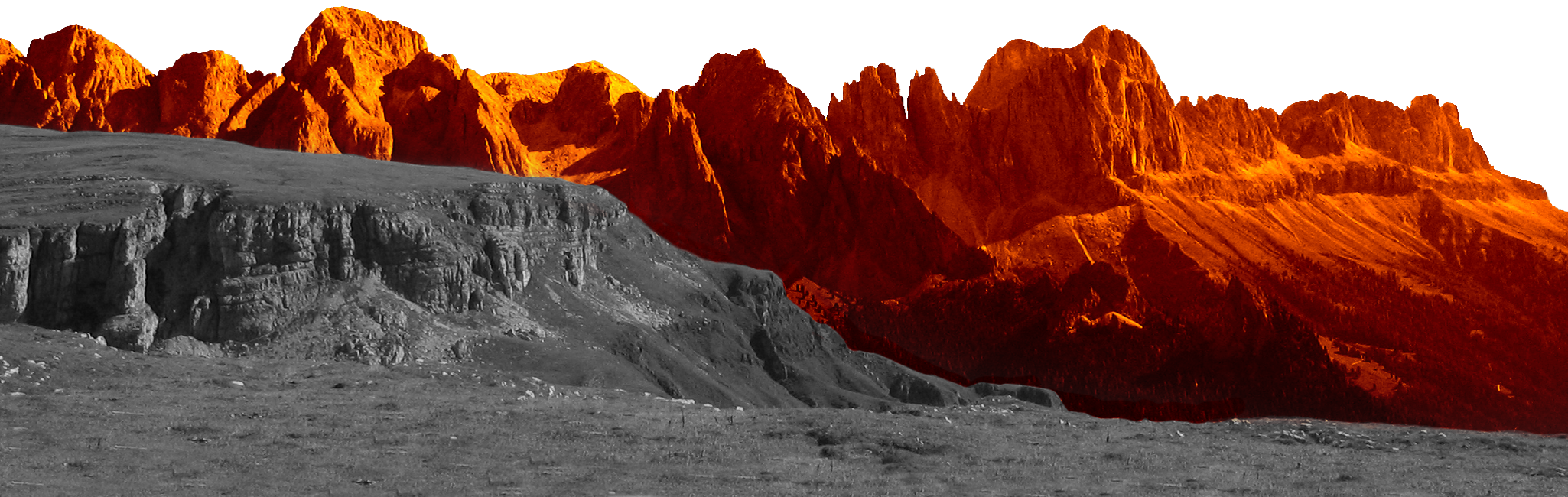
The two routes are identical up to the highest point at Passo Principe at 2,601 meters above sea level. The “short” route is then 36 kilometers long and runs downhill through the Tschamin Valley back to Tiers, while the long route has two more tough climbs to conquer from 22.5 kilometers onwards: the Molingnon Pass and the Tschafon. The reward for the exertions on both routes is an indescribable panorama in the heart of the Dolomites, which have been a UNESCO World Heritage Site since 2009. The defending champions are local hero Daniel Pattis (Tiers) and the Swiss Anne-Catherine Rigort on the 45km, as well as Lukas Mangger (Ridnaun) and the German South Tyrolean Severine Petersen on the 36km.
Technical terrain and a unique panorama
But it is not the length of the route and the many meters of altitude that make the Rosengarten Schlern Skymarathon a challenging trailrun event. The participants are challenged by the terrain. “The technical terrain pushes trail runners to their limits, but it's precisely this challenge that they love,” say the organizers from the Tiers Tourist Office, who organize the ski marathon in collaboration with DYNAFIT.
A race that deliberately does not want to be a mass event and is still one of the insider tips in trail running circles. With the most varied terrain without asphalt and its many technical passages on predominantly narrow and stony paths, the Rosengarten Schlern Skymarathon has provided an unforgettable and unmistakable nature and sports experience since its premiere in summer 2017.
Who are the 500 lucky participants?
Registrations for the South Tyrolean trail spectacle have been accepted on the official website www.skymarathontiers.it since January 1, 2025. The participation fee until 31 May 2025 is 80 euros for the long route over 45 kilometers and 3,000 meters of altitude, and 75 euros for the short route over 36 kilometers and 2,000 meters of altitude. From June 1, 2025, the prices will be raised slightly to 95 euros and 90 euros respectively.


 We use cookies