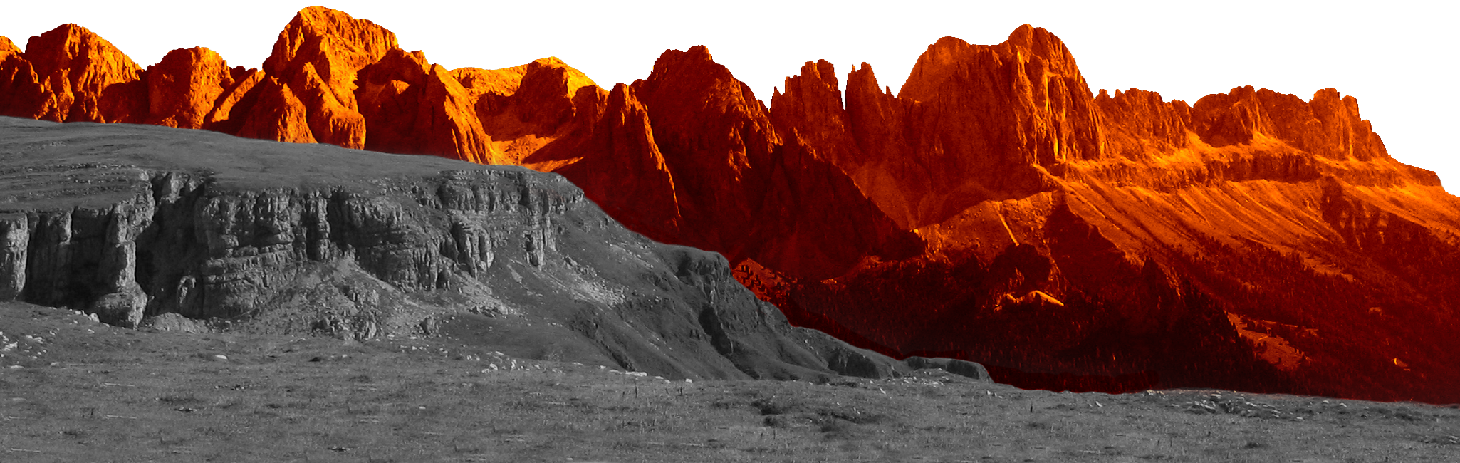
Preparations for one of the most scenic trail runs in Europe are in full swing just over three months before the starting signal on Saturday, 12 July. Hundreds of enthusiastic mountain sports enthusiasts are once again expected to take part in the classic event in the heart of the Dolomites UNESCO World Heritage Site, which will be held for the eighth time this year.
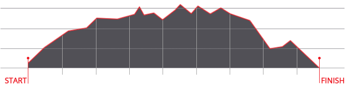
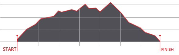
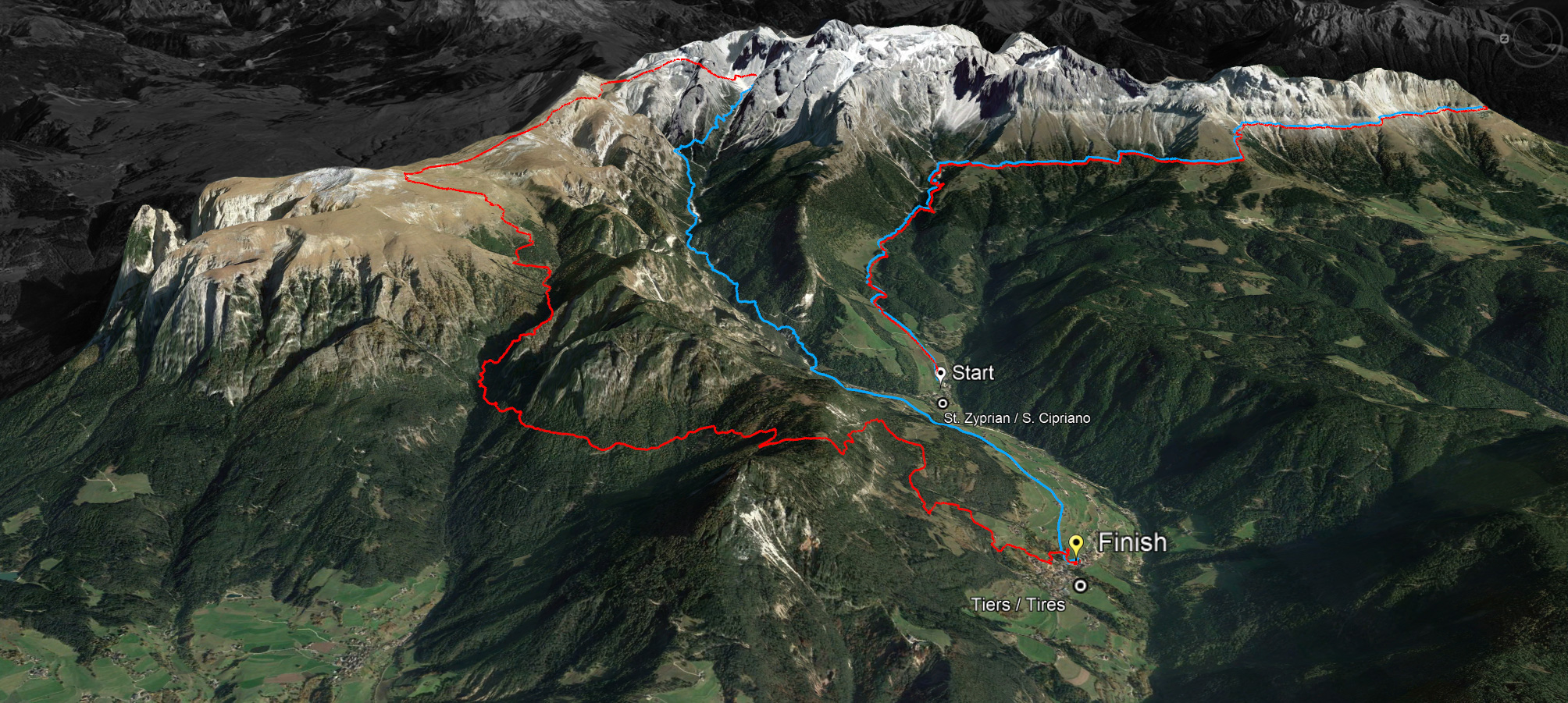
Over 200 registrations for the Rosengarten Schlern Skymarathon have been received by the busy organisers in recent weeks. This means that almost half of the maximum 500 starting places for the renowned trail event in the heart of South Tyrol have been allocated, where participating athletes can once again choose from two different routes this year. On the one hand, there is the somewhat longer and therefore inevitably more challenging distance of 45 kilometres with around 3,000 metres of elevation gain. And on the other hand, there is the ‘shorter’ variant with a length of 36 kilometres and approx. 2000 metres of altitude.
The Grasleiten Pass at an altitude of 2601 metres above sea level has to be conquered by all mountain sports enthusiasts after the start in Tiers. Participants on the ‘short’ route then head downhill via the Tschamin Valley back to the finish in Tiers. The long route is completely different: from kilometre 22.5 onwards, the Molingnon Pass and the Tschafon are two more tough climbs awaiting the trail runners, who come to the Catinaccio/Rosengarten region from all over the world. Among them is last year's winner Severine Petersen. The South Tyrolean by choice, who comes from Germany, triumphed over the 36-km distance in 2024 and has already confirmed her participation for this year. "What I love most about the Rosengarten Schlern ski marathon is that you cross an entire mountain massif - the realm of King Laurin, so to speak - and constantly have the unique panorama of the rugged Dolomites in front of you. This year I will probably be at the start of 13 trails and a few road races. I'm looking forward to the start of a great season!" says Petersen.
Not only are the participating athletes looking forward to the event, but also the support from partners and sponsors. "We are fortunate to be able to work with numerous companies that not only operate locally, but are also very successful on an international level, like our main sponsor DYNAFIT. Without their help, we would not be able to hold the Rosengarten Schlern Skymarathon, just as we would not be able to do so without the support of numerous organisations, clubs and our helpers. We would therefore like to thank them in advance," said the organisers.
Registrations for the South Tyrolean trail spectacle on Saturday, 12 July 2025 are still being accepted on the official website www.skymarathontiers.it. Until 31 May, which is just under two months away, the registration fee for the long distance (45 km/approx. 3000 m elevation gain) is 80 euros. To take part in the shorter distance (36 km/approx. 2000 m elevation gain), the fee is 75 euros. From 1 June 2025, the prices will be raised slightly to 95 euros and 90 euros respectively. The participation fee includes a starter pack with sponsor gifts, a finisher medal, use of the refreshment stations, access to the first aid and rest area in the finish area, a free shuttle service between the start and finish area, free parking, a drink and a meal at the summer party in the finish area, as well as the bag depot in the race office and the return transport of the bags labelled by the runners from the start area to the race office. The time limit is set at ten hours. Participants who reach the checkpoint at the Rotwand hut after 11.30 a.m. will be removed from the classification for safety reasons.


 We use cookies