Rosengarten Schlern Sky Marathon, the individual challenge in the heart of the Dolomites, is held in "speedup" style. The fourth edition of the Rosengarten Schlern Sky Marathon, a trail running race in the heart of the Dolomites, which is organised under the patronage of Dynafit, has been postponed to next year due to the Covid19 pandemic. However, the organizing committee and the snow leopard brand did not let themselves be discouraged and developed an "individual" challenge along the race course, which starts on Saturday, July 11th and ends on Friday, September 11th. 


Proposed hashtag: #speedup
HOW TO PARTICIPATE IN THE ROSENGARTEN SCHLERN SKY MARATHON #COVIDEDITION
Participants can download the route on their sports watch, which can be found in Facebook, as the route cannot be permanently marked for the entire summer season. Their performances must then be downloaded in the appropriate group on the Strava platform and after Friday 11 September the final ranking will be published.
All the rules of "social distancing" to limit the spread of the coronavirus must be respected, so participants must wear the mask if they wish to enter any of the refuges located every four or five kilometres along the route.


abendrot

45 km

LONG ROUTE
Ascent: ca. 2.980 m
Descent: ca. 3.083 m
Download GPX-Track

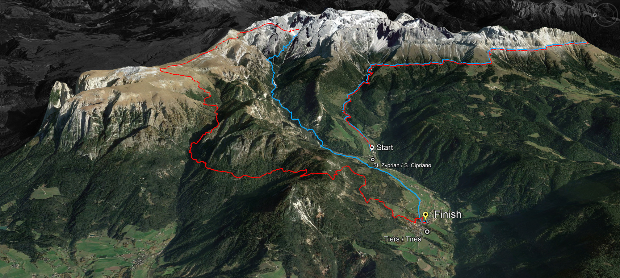
The long route of 45 kilometres with a 2,980 metre ascent and a 3,083 metre descent leads over the Cigolade Pass (variant towards Ciamedie and Gardeccia if unviable), the Passo Principe/Grasleitenpass and the Molignon Pass to the Sciliar; after the Devil's Gorge - also known as the Prügelweg – a final ascent leads up to the Tschafon before the finish line in the centre of the village of Tiers.
Due to its length and the difference in altitude it is a mountain marathon. The name "Sky Marathon" describes the length and alpine characteristics of the trail run at over 2,000 metres. 
noasphalt

profil45

36 km

SHORT ROUTE
Ascent: ca. 1.908 m
Descent: ca. 1.935 m
Download GPX-Track

The short route stretches over 36 kilometres with 1,908 metres of ascent and 1,935 metres of descent. It follows the same route as the long track around the Rosengarten massif until the highest peak, Passo Principe/Grasleitenpass. Then it leads down to the Rufugio Bergamo/Grasleitenhütte, through Ciamin Valley/Tschamintal, Lavina Bianca/Weißlahnbad e Oberstraße back to the centre of the village of Tiers.
profil36

karte

karte

karte
© geiger-webdesign.com
We use cookies

We use cookies on our website. Some of them are essential for the operation of the site, while others help us to improve this site and the user experience (tracking cookies). You can decide for yourself whether you want to allow cookies or not. Please note that if you reject them, you may not be able to use all the functionalities of the site.