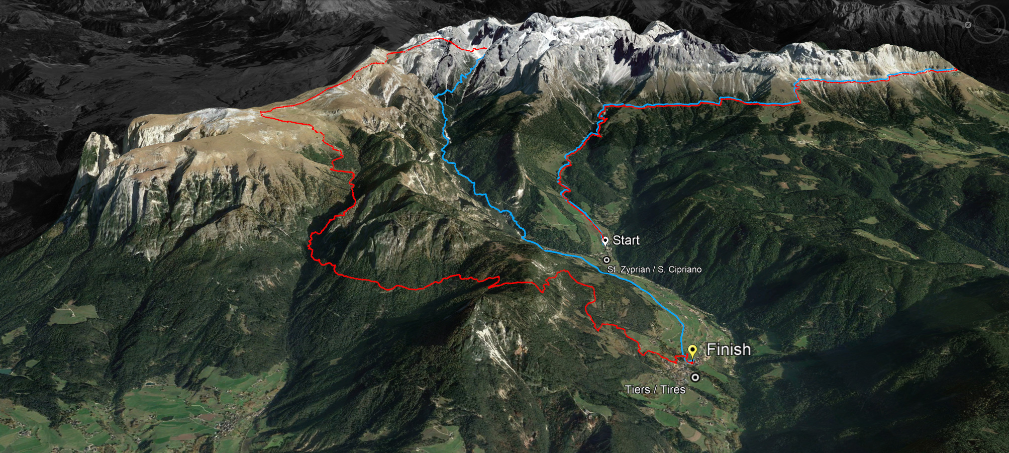
Running in the UNESCO World Natural Heritage Site: experience a unique mountain landscape and push your limits. This is the Rosengarten Schlern Skymarathon in the holiday region Seiser Alm - South Tyrol - Dolomites. Maximum 500 athletes can apply.

The cooperation with the main sponsor Dynafit is sealed and numerous other local sponsors also support this unique running event in Tiers, which will take place on 10 July 2021.
Defending champions over the 45 kilometres are Julia Kessler from Merano and Andreas Ruedlinger from Switzerland, as well as Adela Stranska from the Czech Republic and Daniele Felicetti from Trentino over the 36 kilometres. They will be invited by the organizers to come and defend their title.
Eligible to participate are women and men who have reached the age of 18 on 10 July 2021. Four men's and three women's categories will be judged (M1 18 to 39 years / M2 40 to 49 years / M3 50 to 59 years and M4 over 60 years as well as W1 18 to 39 years / W2 40 to 54 years and W3 over 55 years).
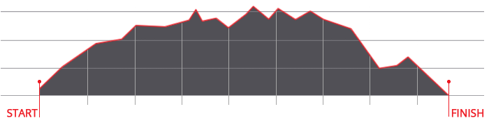
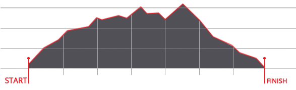
Until 31 May 2021, the participation fee is € 60 for the long distance over 45 kilometres and 3,000 metres of altitude difference and € 55 for the short distance over 36 kilometres and 2,000 metres of altitude difference.

abendrot

45 km

LONG ROUTE
Ascent: ca. 2.980 m
Descent: ca. 3.083 m
Download GPX-Track

The long route of 45 kilometres with a 2,980 metre ascent and a 3,083 metre descent leads over the Cigolade Pass (variant towards Ciamedie and Gardeccia if unviable), the Passo Principe/Grasleitenpass and the Molignon Pass to the Sciliar; after the Devil's Gorge - also known as the Prügelweg – a final ascent leads up to the Tschafon before the finish line in the centre of the village of Tiers.
Due to its length and the difference in altitude it is a mountain marathon. The name "Sky Marathon" describes the length and alpine characteristics of the trail run at over 2,000 metres. 
noasphalt

profil45

36 km

SHORT ROUTE
Ascent: ca. 1.908 m
Descent: ca. 1.935 m
Download GPX-Track

The short route stretches over 36 kilometres with 1,908 metres of ascent and 1,935 metres of descent. It follows the same route as the long track around the Rosengarten massif until the highest peak, Passo Principe/Grasleitenpass. Then it leads down to the Rufugio Bergamo/Grasleitenhütte, through Ciamin Valley/Tschamintal, Lavina Bianca/Weißlahnbad e Oberstraße back to the centre of the village of Tiers.
profil36

karte

karte

karte
© geiger-webdesign.com
We use cookies

We use cookies on our website. Some of them are essential for the operation of the site, while others help us to improve this site and the user experience (tracking cookies). You can decide for yourself whether you want to allow cookies or not. Please note that if you reject them, you may not be able to use all the functionalities of the site.