Rosengarten Schlern Skymarathon 2022 cancelled

Due to a tragic death in the OC team, the entire village is in mourning.
In consultation with partners and sponsors, it was decided to cancel the Rosengarten Schlern Skymarathon 2022. "It is always tragic when a person is torn out of life in the middle of life. In a small village like Tiers, where practically the entire village community works on the run on a voluntary basis, the decision to cancel the run is absolutely justified", says Heiner Oberrauch, President of Operalp Group, which owns the band of the main sponsor Dynafit.

Around 350 runners from 15 nations were registered. Since many runners from abroad have already booked their stay, some local runners will meet at 7.00 a.m. at the parking lot opposite the Hotel Cyprianer Hof to tackle the route with interested parties in smaller groups on their own without timekeeping, without safety officers and without refreshment stations.


"We ask for everyone's understanding for the cancellation. The entire village is involved in this event, and given the tragic circumstances, it is inconceivable to hold the Rosengarten Schlern Skymarathon 2022," explains david Rieder, president of the tourist board.
Registration will be automatically transferred to July 8, 2023, unless a refund of the entry fee is requested.


abendrot

45 km

LONG ROUTE
Ascent: ca. 2.980 m
Descent: ca. 3.083 m
Download GPX-Track

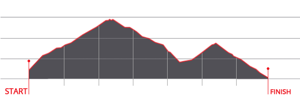
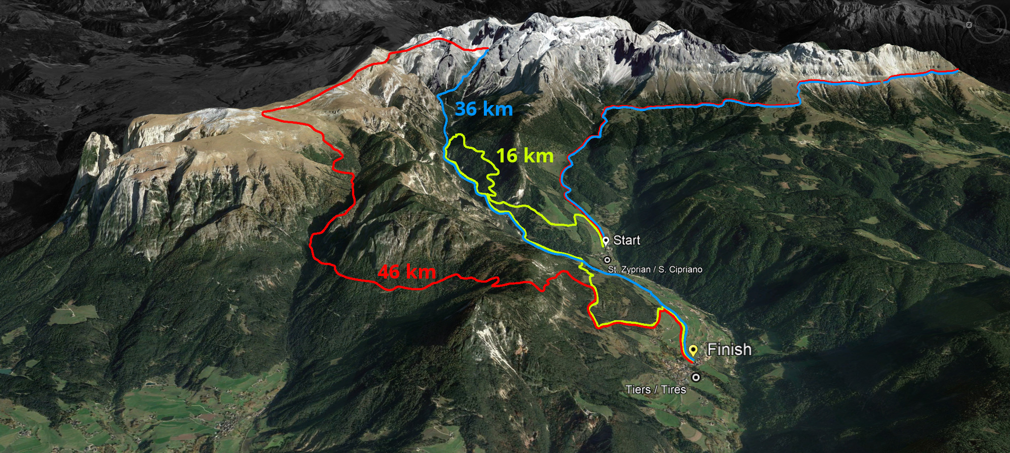
The long route of 45 kilometres with a 2,980 metre ascent and a 3,083 metre descent leads over the Cigolade Pass (variant towards Ciamedie and Gardeccia if unviable), the Passo Principe/Grasleitenpass and the Molignon Pass to the Sciliar; after the Devil's Gorge - also known as the Prügelweg – a final ascent leads up to the Tschafon before the finish line in the centre of the village of Tiers.
Due to its length and the difference in altitude it is a mountain marathon. The name "Sky Marathon" describes the length and alpine characteristics of the trail run at over 2,000 metres. 
noasphalt

profil45

36 km

SHORT ROUTE
Ascent: ca. 1.908 m
Descent: ca. 1.935 m
Download GPX-Track

The short route stretches over 36 kilometres with 1,908 metres of ascent and 1,935 metres of descent. It follows the same route as the long track around the Rosengarten massif until the highest peak, Passo Principe/Grasleitenpass. Then it leads down to the Rufugio Bergamo/Grasleitenhütte, through Ciamin Valley/Tschamintal, Lavina Bianca/Weißlahnbad e Oberstraße back to the centre of the village of Tiers.
profil36

karte

karte

karte
© geiger-webdesign.com
We use cookies

We use cookies on our website. Some of them are essential for the operation of the site, while others help us to improve this site and the user experience (tracking cookies). You can decide for yourself whether you want to allow cookies or not. Please note that if you reject them, you may not be able to use all the functionalities of the site.